Tag Archives: maps

Nodal Points

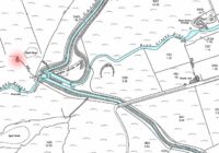
In geography a nodal point is the point at which different transport links come together. Nodal points are sometimes referred to as route centres. Nodal Point Examples Examples of nodal points include roads arriving together, a confluence of rivers or a rail junction. Nodal points are often associated with settlement sites, such as a town,… Read More »

Extract Data From Maps QGIS

In this blog post I’ll show you how to extract data from maps using QGIS to georeference a map image and identify data points. The steps are: Start with a map image containing data you want to capture, such as marked locations Add a base map to QGIS that you will load the map image… Read More »

WW2 Unit Frontages

The frontage of a unit is the length of the front line that a unit is responsible for. In this post I have summarised the approximate frontages for a range of world war two units, from a section of around 10 men up to a division of around 10,000 men. WW2 Unit Frontages The summary… Read More »

Time Team Map of Episodes

Time Team was a TV series which involved a team of archaeologists, surveyors, artists and other specialists spending three days to investigate an archaeological site. Episodes were mainly focused on the UK, but there were also some as far afield as Spain and America. I thought it would be interesting to see how episodes were… Read More »