Tag Archives: data

Extract Data From Maps QGIS

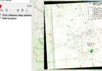
In this blog post I’ll show you how to extract data from maps using QGIS to georeference a map image and identify data points. The steps are: Start with a map image containing data you want to capture, such as marked locations Add a base map to QGIS that you will load the map image… Read More »
Data Storytelling

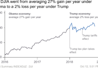
Inspired by the Storytelling With Data book I wanted to try applying some of the techniques to some existing charts and graphs. In all the examples I have been limited in not having access to the original data, so re-plotting hasn’t really been possible. Instead, I have redrawn using Inkscape or Excel and then focused… Read More »