Tag Archives: maps

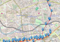
Folium Marker Clusters

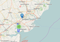
Marker clusters can be a good way to simply a map containing many markers. When the map is zoomed out nearby markers are combined together into a cluster, which is separated out when the map zoom level is closer. In this post I show you how Folium marker clusters are easy to set up and… Read More »

Folium Map Tiles

Using different map tiles can be a great way to change or improve the look of your map. This post shows you how to access Folium map tiles and switch between them. Folium Map Tiles Basic Code The basic code for changing the map tiles used by folium is to first add a specified tile… Read More »

Plot Lines In Folium

In this post I show you how to plot lines in Folium – the python module for plotting leaflet maps. Add PolyLine to Map Like ‘markers’, lines are added to folium map objects with the add_to() method where “points” is a list of tuples containing latitude and longitude information, and “my_map” is a folium map… Read More »

Where Were the 5000 Small Business Owners?

Where Were the 5000 Small Business Owners? A bit of a backlash A couple of days ago the Daily Telegraph published a list of 5000 small business owners who signed a letter in support of David Cameron’s Conservative party. Since it’s publication, however, there has been a bit of a backlash, with the letter being… Read More »

Map of World War 2 Air Ferry Routes

Map of World War 2 Air Ferry Routes During the World War 2 air ferry routes were used to safely transport equipment, personel and supplies across the globe. Search for the Atlantic Ferry Routes on Amazon [Sponsored Link] The wikipedia articles for the main routes didn’t seem to have a map image, so I thought… Read More »