Category Archives: python

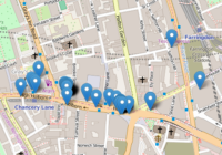
Plot Lines In Folium

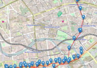
In this post I show you how to plot lines in Folium – the python module for plotting leaflet maps. Add PolyLine to Map Like ‘markers’, lines are added to folium map objects with the add_to() method where “points” is a list of tuples containing latitude and longitude information, and “my_map” is a folium map… Read More »

Python GPX Import Coordinates

Gpx (GPS Exchange Format) is a common file format used to store exported GPS data. In this post I use the python module gpxpy to simply import the gpx coordinates from a gpx file. Search for Python Geospatial Analysis on Amazon [Sponsored Link] Python GPX Import Made Easy With gpxpy A Python GPX import is… Read More »

Anaconda SPARQL Installation

Anaconda SPARQL Install With rdflib Package There are a few different Anaconda SPARQL options available for Python, but I’ve had some success installing the package SPARQLWrapper. You can install the SPARQLWrapper package by loading up the Anaconda Command Prompt and running: which should download and install the most recent version of the package. Go to… Read More »