Category Archives: python

Anaconda Python Environments

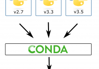
Have multiple versions of Python on the same system with Anaconda Python environments. It can be good to have multiple versions of python on the same system for testing, development, or just to use packages only available in Python 2.7. If you try to do a conventional install of multiple python versions, you will probably… Read More »

UK University Locations

The UK has around 160 universities, located around the country. Here is a map of UK University Locations, made using Folium.   Download the UK university locations data [csv] Access the list of UK universities Python Code For UK University Locations How to convert postcodes to coordinates

Convert Postcode Coordinates

It’s common to have the postcode of an address and need to plot this on a map. In this post I show you two options for how to convert postcode coordinates using an online tool or data available for free online. Option 1. Use an Online Conversion Tool Often the easiest way to convert postcode… Read More »

Folium Marker Clusters

Marker clusters can be a good way to simply a map containing many markers. When the map is zoomed out nearby markers are combined together into a cluster, which is separated out when the map zoom level is closer. In this post I show you how Folium marker clusters are easy to set up and… Read More »

Folium Map Tiles

Using different map tiles can be a great way to change or improve the look of your map. This post shows you how to access Folium map tiles and switch between them. Folium Map Tiles Basic Code The basic code for changing the map tiles used by folium is to first add a specified tile… Read More »