Python OSGB to WGR84
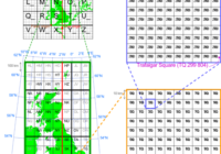
OSGB is the Ordnance Survey National Grid and is used for many grid references in the United Kingdom. This grid system works well for locations within the United Kingdom, but needs work if you need to combine coordinates from another system, or perhaps plot locations on open streetmap. In this post I look at python… Read More »
