Tag Archives: python

Plot Lines In Folium

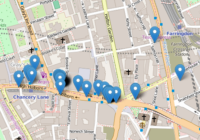
In this post I show you how to plot lines in Folium – the python module for plotting leaflet maps. Add PolyLine to Map Like ‘markers’, lines are added to folium map objects with the add_to() method where “points” is a list of tuples containing latitude and longitude information, and “my_map” is a folium map… Read More »
Python GPX Import Coordinates

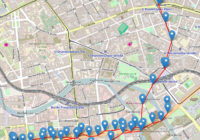
Gpx (GPS Exchange Format) is a common file format used to store exported GPS data. In this post I use the python module gpxpy to simply import the gpx coordinates from a gpx file. Search for Python Geospatial Analysis on Amazon [Sponsored Link] Python GPX Import Made Easy With gpxpy A Python GPX import is… Read More »

Software Carpentry

Software Carpentry is a non-profit organisation that teaches computing, coding and programming skills to researchers using face-to-face and online courses. I’ve found Software Carpentry to be very useful throughout my computing career and would definitely recommend it to anyone looking to gain a good understanding of computing principles. Software Carpentry Not Software Engineering The term… Read More »