Category Archives: GIS

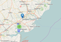
Convert Postcode Coordinates

It’s common to have the postcode of an address and need to plot this on a map. In this post I show you two options for how to convert postcode coordinates using an online tool or data available for free online. Option 1. Use an Online Conversion Tool Often the easiest way to convert postcode… Read More »

Folium Marker Clusters

Marker clusters can be a good way to simply a map containing many markers. When the map is zoomed out nearby markers are combined together into a cluster, which is separated out when the map zoom level is closer. In this post I show you how Folium marker clusters are easy to set up and… Read More »

Folium Map Tiles

Using different map tiles can be a great way to change or improve the look of your map. This post shows you how to access Folium map tiles and switch between them. Folium Map Tiles Basic Code The basic code for changing the map tiles used by folium is to first add a specified tile… Read More »

Plot Lines In Folium

In this post I show you how to plot lines in Folium – the python module for plotting leaflet maps. Add PolyLine to Map Like ‘markers’, lines are added to folium map objects with the add_to() method where “points” is a list of tuples containing latitude and longitude information, and “my_map” is a folium map… Read More »