Europe World War 2 Shapefiles
Europe World War 2 Shapefiles
Europe World War 2 Shapefiles
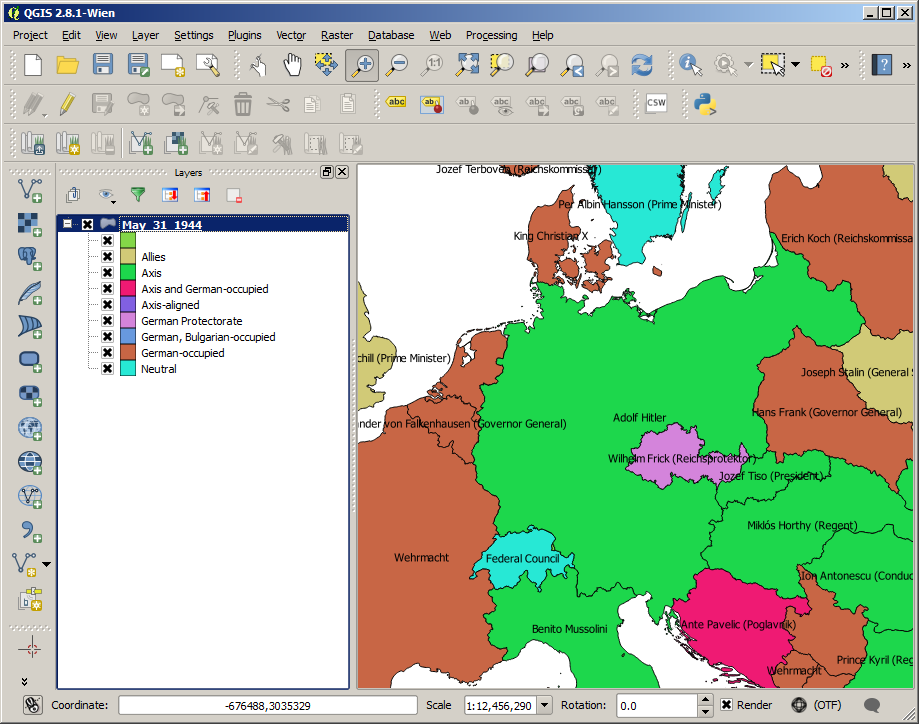
After spending some time searching World War 2 shapefiles for Europe, I’ve finally found some. This collection of shapefiles from the Stanford Spatial History Project covers the changes in borders, governments and allegiences throughout the conflict. Shapefiles are provided for a month-by-month representation of the changes. Other details include:
- Country names
- Head of state
- Foreign policy
- Land area
- Length of borders
- Governments in exile
Download the shapefiles from Building the New Order: 1938-1945
Using QGIS it’s easy load the shapefiles to view and manipulate them. Here I’ve colour coded the regions according to foreign policy situation and labelled with the head of state at the time.
 |
|---|
| World War 2 Shapefiles |
This post is licensed under CC BY 4.0 by the author.